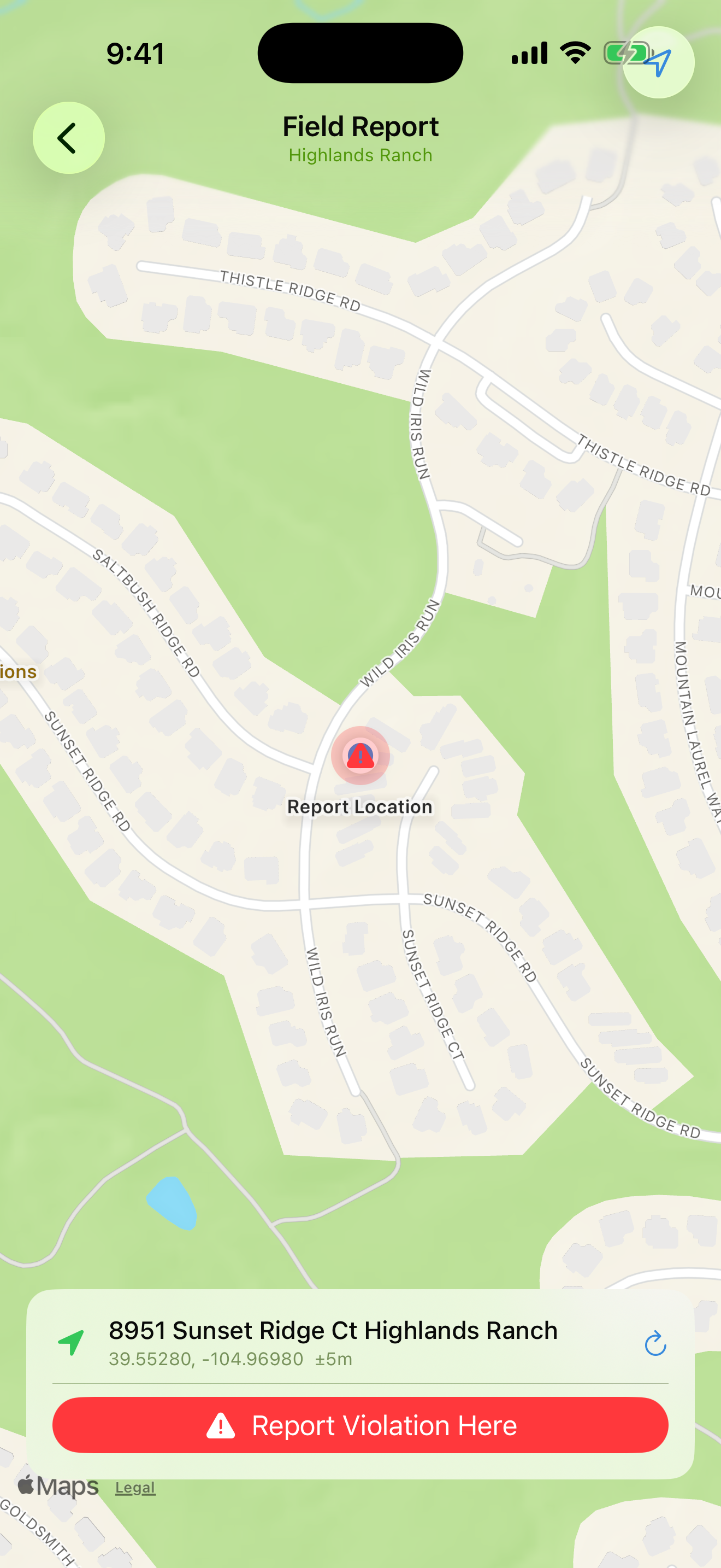
GPS-Powered Field Reporting
Log violations directly from the property with auto-captured GPS coordinates, address reverse-geocoding, and photo evidence — all without typing a single street address.
GPS Module
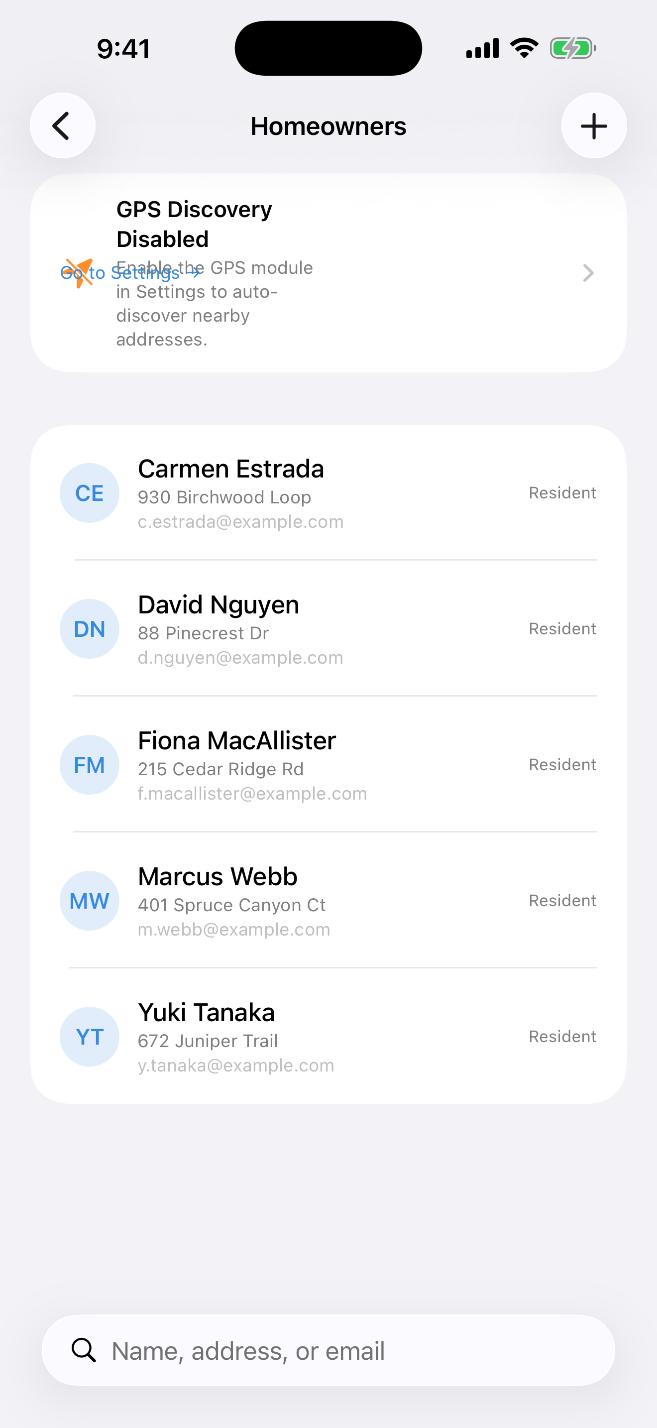
One-Tap Address Discovery
Scan up to 500 yards around your location and automatically import every residential address found — no manual entry. Configurable radius, adjustable in Settings.
GPS Module
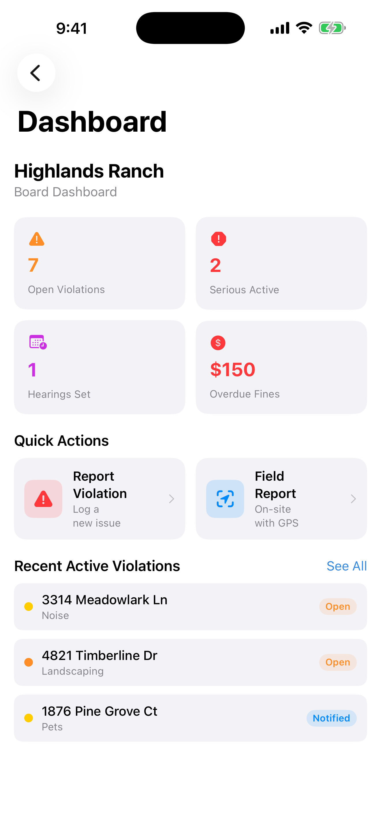
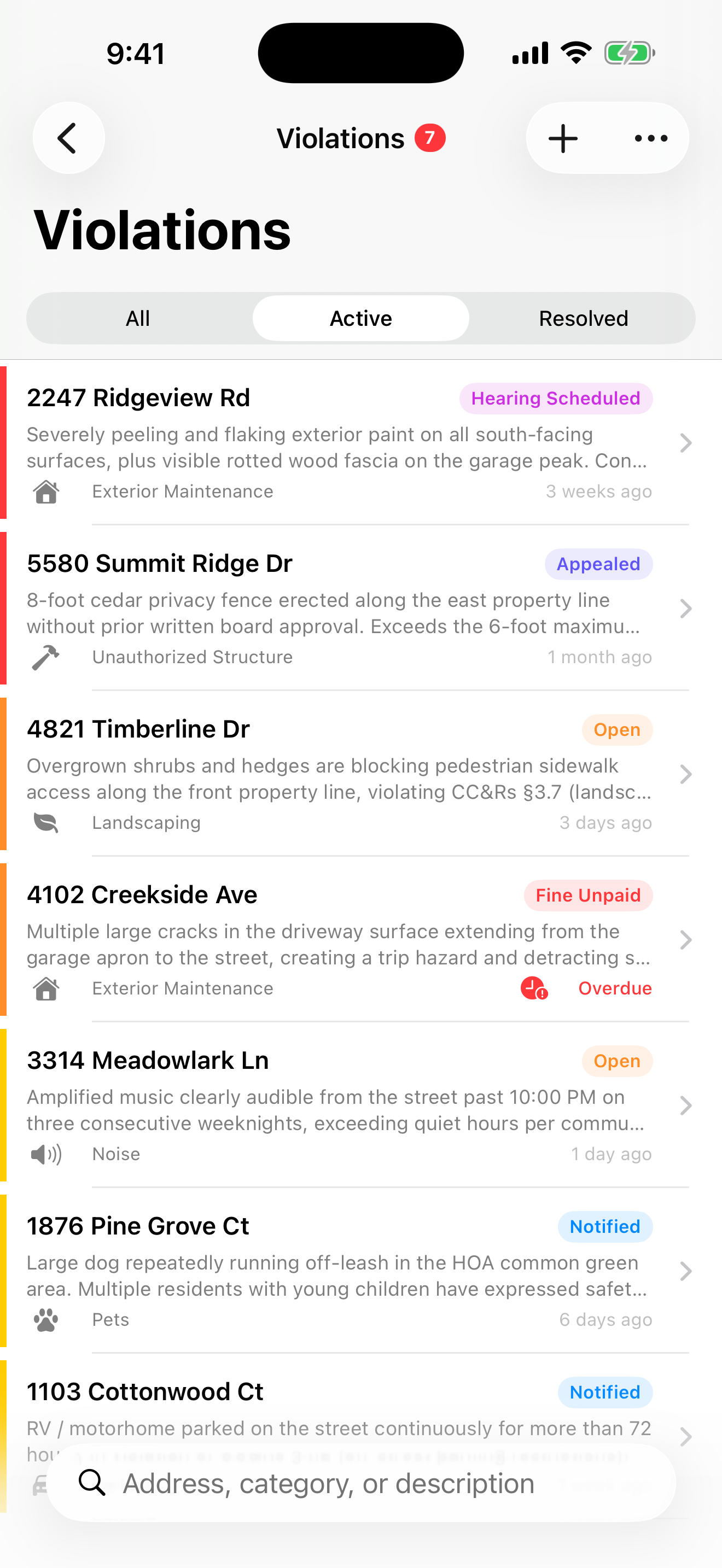
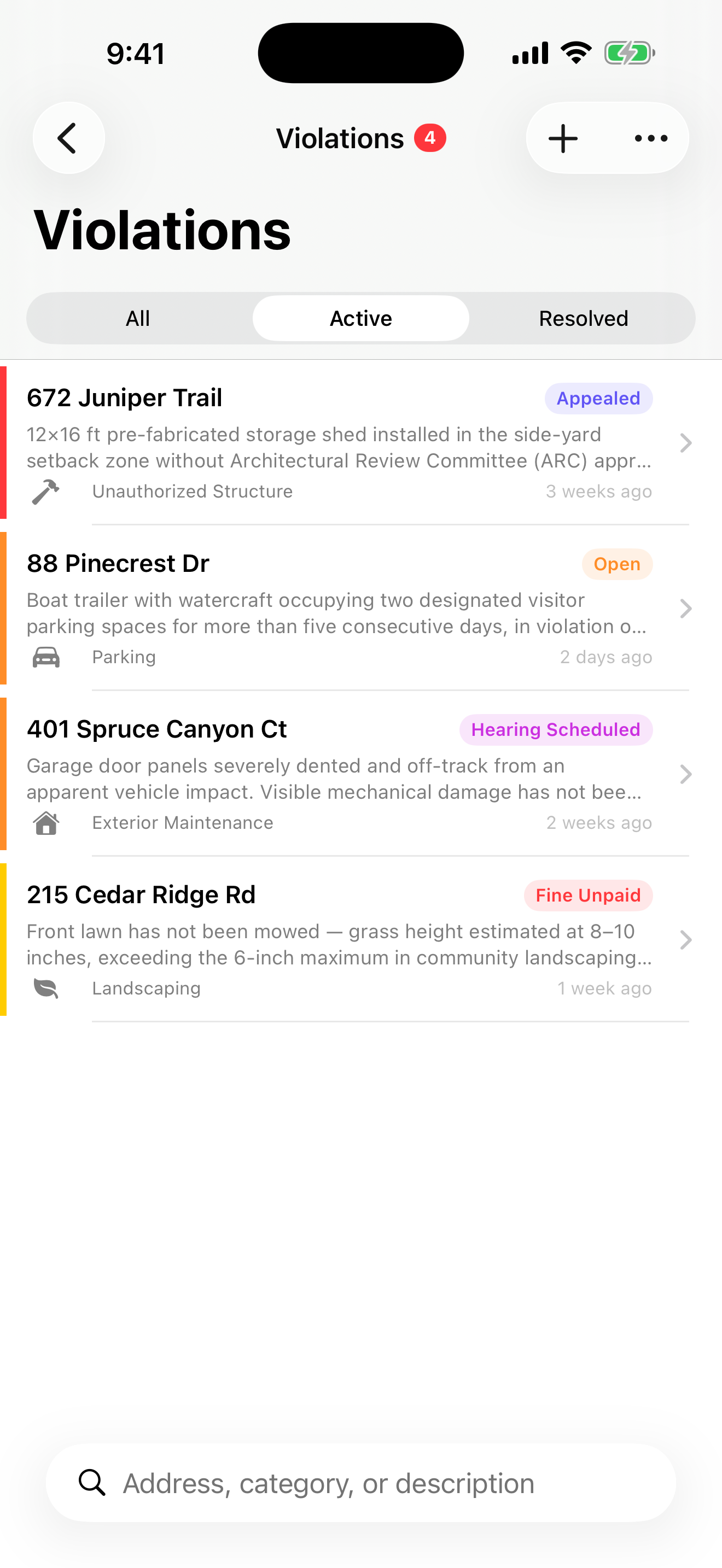
Violation Tracking
Create, assign, and resolve violations with a full workflow — Open → Noticed → Warned → Fined → Resolved. Attach photos, notes, and a complete audit timeline to every case.
Core
Resident Management
Full CRUD for homeowners — name, address, email, phone, unit number, and role. Activate or deactivate residents, search by name or address, and bulk-import nearby properties.
Core
Property Owner Lookup
Tap "Look Up Owner" on any address to query public parcel records via the Regrid API and auto-fill the homeowner's legal name — no manual research required.
Regrid API
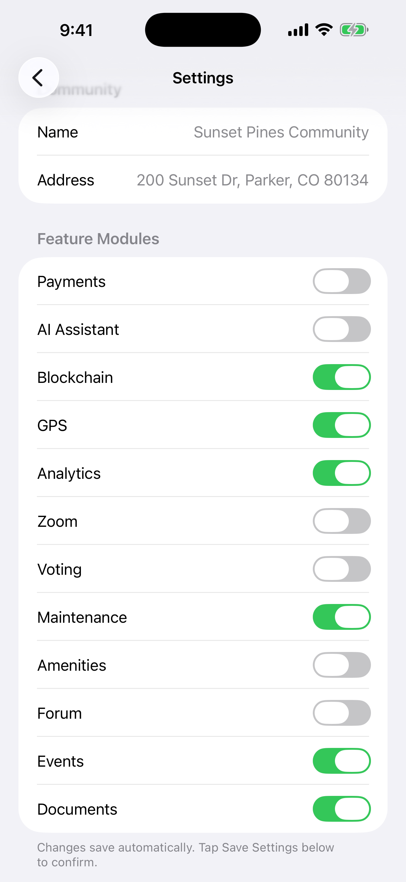
Multi-Community Dashboard
Manage multiple HOAs from a single app session. Switch communities with one tap — each with its own residents, violations, settings, and enabled feature modules.
Core
Community Events
Create and share community events — board meetings, pool closures, landscaping days — with all residents. Keep everyone informed without phone trees or paper flyers.
Events Module
Document Library
Store and share CC&Rs, bylaws, architectural guidelines, and board minutes. Every resident can access the documents they need — anytime, from anywhere.
Documents Module
Analytics & Reports
Trend charts for violations, resolution rates, and community activity. Export reports for board meetings. Identify recurring issues before they become expensive problems.
Analytics Module